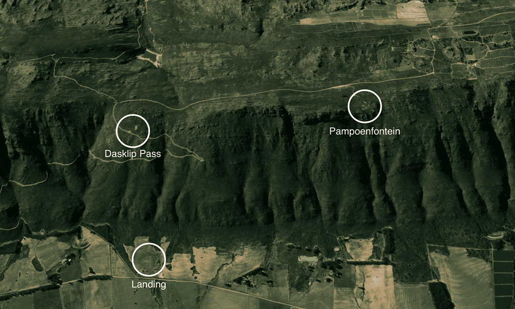
Leeuwenkop (also sometimes incorrectly referred to as Pampoenfontein) is the preferred Porterville alternative to Dasklip Pass as it is higher, faces more directly into the prevailing thermic cross-wind, and is generally safer for XC pilots. The thermals are usually strong so you can get away quickly. There is a big ridge close to launch.
Weather
- West (W) – South South West (SSW)
- Thermic South East (SE) days
- Wind talker based at Leeuwenkop (live reading)
Geography
- GPS: S32o55.616’ E19o02.235’
- Altitude: 800m (ASL)
- Airspace ceiling: 2900m.
Launch
If the wind is straight, it’s best to launch from the carpark. Alternatively, there’s a wide ledge with netting below, easy for experienced pilots but a bit challenging for first-timers (cliff launch). There’s a good run-off here for hanggliders. There is a large amount of space in the surrounding fynbos as well. Toplanding is possible.
Landing
Directly below launch is a field to the right of a square forest (Grootelsbos). Land either side of the gravel road coming in from Porterville, use the ladder or gate.
Cautionary notes
In summer, experienced guidance is highly recommended. Midday thermals can become very strong, especially the house thermal to the left and right of takeoff. The rocks below the launch-site are gnarly – avoid fiddling in your harness and maintain good glider control until well clear of the ridge. In strong thermic conditions it is difficult to judge your launch timing due to the ledge which obscures your view – use an assistant if possible. Expect your glider to lift you as it bites into the wind.
Directions
Continue on the road past Dasklip takeoff around the back. After +- 3km, turn right (uphill). The road climbs out to the front of the ridge.